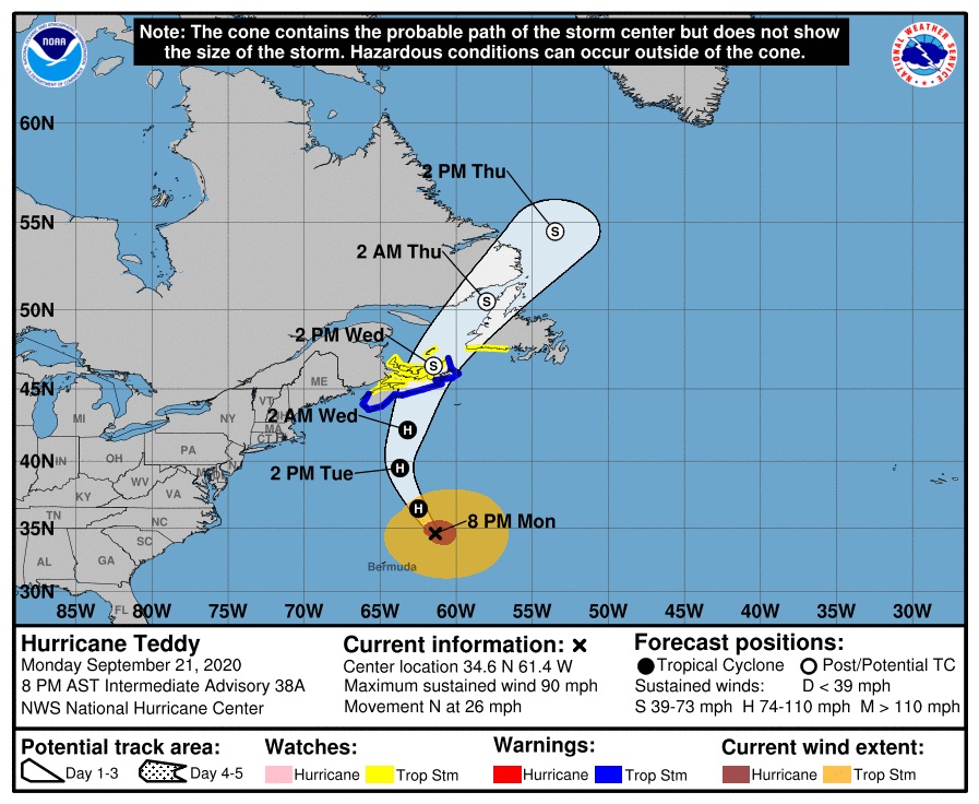
Hurricane Teddy is a large hurricane located roughly 250 miles northeast of Bermuda and 700 miles south of Halifax, Nova Scotia. It is racing off to the north at 26 mph and is expected to transition into a post-tropical cyclone as it enters cooler waters of the North Atlantic. While it is entering an area less favorable for tropical development, it is entering an area ripe for robust transformation into a potent storm.
Ahead of its Canadian landfall, a variety of watches and warnings have been issued. A Tropical Storm Warning is in effect for the south coast of Nova Scotia from Digby to Meat Cove while a Tropical Storm Watch is up from Meat Cove to Tidnish, north of Digby to Fort Lawrence, for the Magdalen Islands, Prince Edward Island, and from Port aux Basques to Francois, Newfoundland. A Tropical Storm Warning means that tropical storm conditions are expected within the warning area. A Tropical Storm Watch means that tropical storm conditions are possible within the watch area.
Teddy should continue its northward march tonight, followed by a turn to the north-northwest on Tuesday. Teddy
should then turn to the north-northeast and move over eastern Nova Scotia on Wednesday then over the Gulf of St. Lawrence late Wednesday into Thursday.
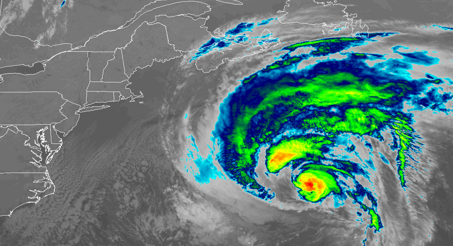
Teddy is a large hurricane now, with hurricane force winds extending outward up to 80 miles from the center; tropical storm force winds extend upwards of 275 miles from the center. While Teddy is now a Category 1 hurricane with 90 mph winds, the National Hurricane Center is forecasting it’ll gain additional strength tonight. By Wednesday, Teddy should weaken again but will become a strong post-tropical cyclone before reaching the Nova Scotia coast.
Even before Teddy approaches the coast of Canada, it is creating problems across the western Atlantic. Large swells generated by Teddy are impacting Bermuda, the Lesser Antilles, the Greater Antilles, the Bahamas, the much of the U.S. East Coast. These swells are likely to cause life-threatening surf and rip current conditions; some areas could also see coastal flooding.
When Teddy impacts the Canadian coast, 3-6″ of rain is likely along with dangerous storm surge, large and destructive waves, strong storm force winds, and the threat of tornadoes. People in the watch and warning area should take action now to prepare for this storm; those in the warning area should bring to completion their plans to protect life and property ahead of Teddy’s arrival.
