While the eastern United States is carefully watching how a winter storm will evolve in the days before Christmas, perhaps as a Christmas Eve Blizzard, people in Hawaii are also bracing for a severe weather event even though the weather is usually much more tame there. Severe thunderstorms, hail, damaging wind gusts, and accumulating snow are all possible in Hawaii starting tomorrow into Monday.
The National Weather Service office for Hawaii located in Honolulu on the central island of Oahu issued a Special Weather Statement today warning people across the state about the upcoming severe weather threat. According to that statement, the National Weather Service warns that a vigorous cold front is expected to bring strong southwest winds and thunderstorms to Hawaii late Sunday through Monday. Southwest, also known by locals as “Kona Winds”, will increase ahead of the front on Sunday, with gusty conditions initially developing across windward communities, as well as any locations over and downwind of terrain. According to the National Weather Service, these strengthening winds may become damaging Sunday night and Monday. They warn that impacts could include roof damage, downed trees, and power outages.
In addition to strong winds, thunderstorms are also expected throughout the state. According to the Western Regional Climate Center (WRCC), thunderstorms aren’t very common in Hawaii, occurring only 20-30 days out of a typical year, mainly in the higher terrain versus the coastal lowlands. “Even in the mountains, however, tremendous claps of thunder are rare,” says the WRCC. The National Weather Service says thunderstorms may develop as early as Sunday, and some thunderstorms could become strong to severe thunderstorms along and ahead of the front Sunday night and Monday. Any thunderstorms during this time frame could be capable of producing damaging wind gusts and hail over any portion of the state.
Severe thunderstorms are officially defined by the National Weather Service as storms that are capable of producing hail that is an inch or larger or wind gusts over 58 mph.
In addition to high winds, severe thunderstorm risks, and hail, there is also the risk of heavy, flooding rains. At this time, the National Weather Service doesn’t expect chances for widespread flash flooding to be high. But they do caution that leeward communities could experience experience a period of heavy rainfall and potential flood impacts, especially on Maui and the Big Island of Hawaii later Sunday into Monday.
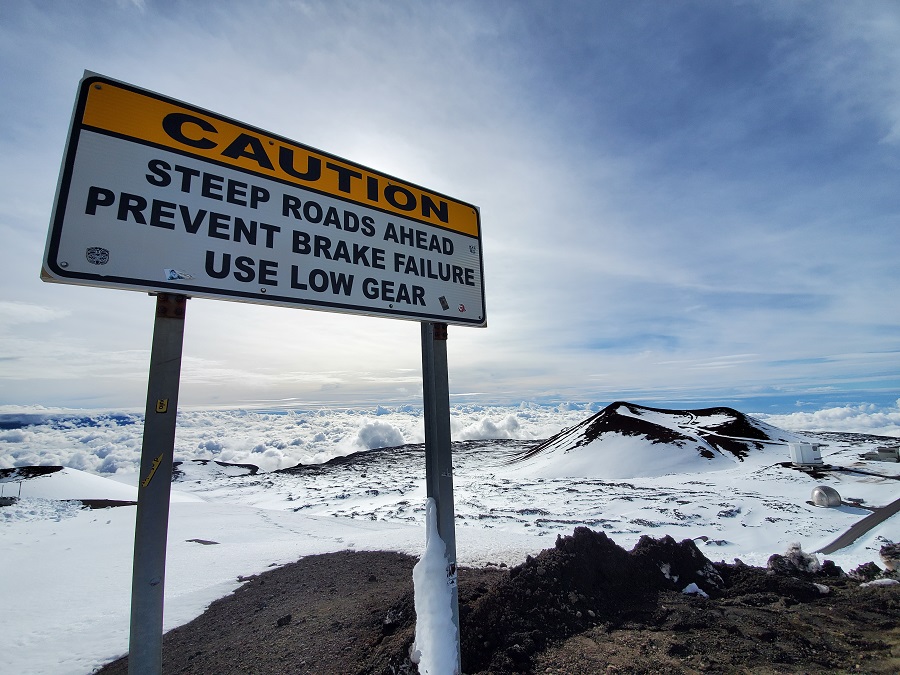
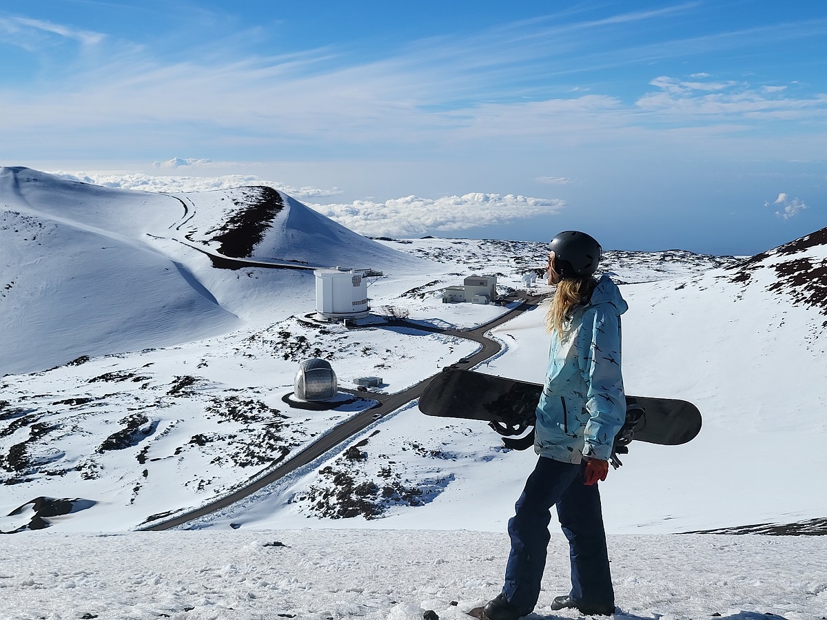
On the higher terrain of Maui and especially the Big Island of Hawaii, blizzard conditions could be possible with heavy snow and even stronger winds. For the highest terrain of Hawaii’s Big Island, the National Weather Service is calling for winds of 29-33 mph tonight increasing to 40-45 mph tomorrow, with gusts to 65 mph. Tomorrow night, winds are expected to increase to 55 to 60 mph after midnight with gusts to 75 mph. On Monday and Monday night, southwest winds of 85-90 mph are forecast, with gusts up to 125 mph possible. Winds will begin to relax on Tuesday, with west northwest winds of 60-70 mph decreasing to 48-58 mph and gusts to 100 mph. By Wednesday, winds will further relax, with west winds of 15-25 mph expected with gusts up to 36 mph possible.
Due to their elevation, the higher terrain of the Big Island will also see accumulating snow. The National Weather Service says an accumulation of 3-7″ is possible on Monday. Even with light snowfall, the combination of extraordinarily high winds and blowing or falling snow could create blizzard conditions here.
While most people associate a blizzard with a heavy snow event, a blizzard is officially defined by wind and visibility –and not by accumulation. To reach official blizzard criteria, you must have blowing and/or falling snow with winds of at least 35 mph, reducing visibilities to a quarter of a mile or less, and such conditions must last for at least three hours. Winds lofting the current snow pack and reducing visibilities without any falling snow is called a ground blizzard and is just as hazardous as a blizzard with freshly falling snow.
Additionally, the powerful low pressure system driving the front will generate a very large and long-lived northwest swell that will affect the islands from Sunday night through Tuesday. The National Weather Service warns that homeowners, beachgoers and boaters should prepare for high surf and significant wave run-up, with possible coastal impacts along exposed north and west facing shores.
For now, a High Surf Advisory is in effect for north and west facing shores of Niihau, Kauai, Oahu, and Molokai and for the north facing shores of Maui and the Big Island. Large breaking waves of 10-15′ and 18-24′ along north facing shores of Oahu, are possible through at least 6am local time Sunday. Moderate, strong breaking waves and currents will make swimming dangerous. The National Weather Service cautions: “Head all advice from ocean safety officials. When in doubt, don’t go out. Stay away from the shoreline along the affected coasts.”
