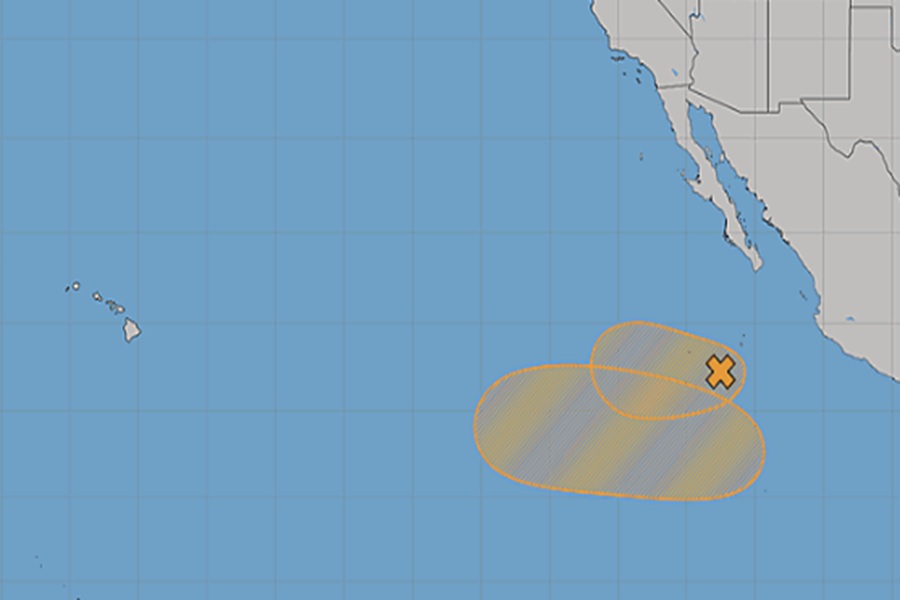
While the Tropical Atlantic has been taking a break since the formation of dissolution of Tropical Storm Arthur, the Eastern Pacific Hurricane Basin has perked up with 2 areas of concern over open waters between Mexico and Hawaii. According to the National Hurricane Center (NHC), some short-term development is possible for at least one of them while the other has a better chance of formation beyond the next 2-3 days.
The NHC says that showers and thunderstorms continue to show signs of organization with an area of low pressure located several hundred miles south-southwest of the southern tip of the Baja California
Peninsula. While there are signs of some organization, earlier satellite wind data from NOAA’s GOES-West suggest the system lacks a well-defined center. A tropical depression could still form within the next day or so while environmental conditions remain favorable for development as the system moves westward to west-northwestward at 15 to 20 mph. However, by Thursday, the system is forecast to move into an unfavorable environment, ending its chances for further development. For now, the NHC gives the system a 50-50 chance of becoming a tropical cyclone in the next 48 hours.
In addition to that system, the NHC says it is likely that a low pressure system will form this weekend or early next week over the central portion of the East Pacific basin. Some slow development of this system is possible after that time, and a tropical depression could form by the early to mid part of next week while it moves westward to west-northwestward at 10 to 15 mph. The NHC says there’s near zero chance of tropical cyclone formation here through the next 48 hours but those odds grow to 40% over the next 7 days.
Long range computer forecast guidance suggests these systems may bring additional moisture near/to the Hawaiian Islands over time, but it’s unlikely, for now, for either of these systems to threaten Hawaii as a tropical cyclone.
As with the Atlantic, the Central and Eastern Pacific hurricane seasons run t
