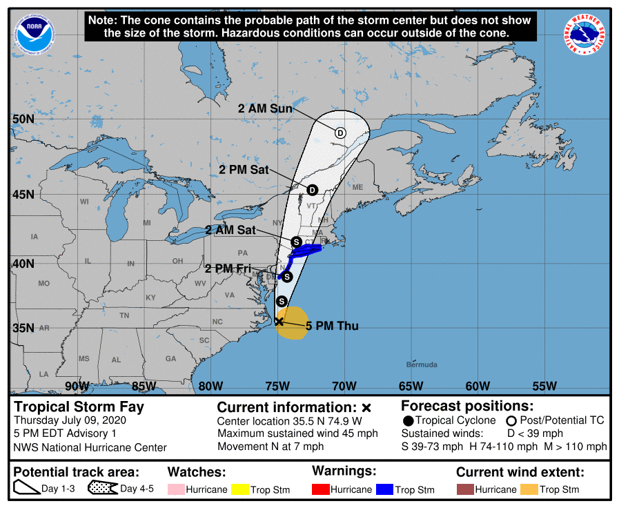
The National Hurricane Center has issued Tropical Storm Warnings ahead of Tropical Storm Fay for portions of New Jersey, New York, and Connecticut. Specifically, a Tropical Storm Warning is in effect for Cape May, New Jersey to Watch Hill, Rhode Island, including all of Long Island and Long Island Sound. A Tropical Storm Warning means that tropical storm conditions are expected somewhere within the warning area within 36 hours.
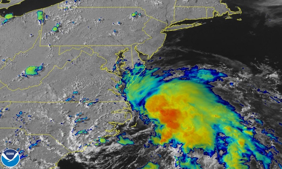
As of 5 pm ET, the center of Tropical Storm Fay was located near latitude 35.5 North, longitude 74.9 West. Maximum sustained winds are at 45 mph with higher gusts. Tropical storm force winds extend outward up to 140 miles from the center of the storm. The latest minimum central pressure reported by reconnaissance aircraft is 1005 mb or 29.68 inches.
For now, Fay is moving toward the north near 7 mph. According to the National Hurricane Center, a northward to north-northeastward motion at a faster forward speed is expected over the next couple of days. On the forecast track, the center of Fay is forecast to move near the mid-Atlantic coast on Friday and move inland over the northeast United States on Saturday. The National Hurricane Center expects additional slight strengthening tonight. As the center of the system moves inland, the storm is forecast to weaken.
Tropical Storm Fay is expected to produce heavy rains that could trigger life-threatening flash floods. 3-5″ will fall near the track of Fay across Delaware, New Jersey, eastern Pennsylvania, and eastern Upstate New York.
Strong, potentially damaging winds will lash the coast; the strongest are expected at the immediate Jersey Shore and South Shore of Long Island. Tropical storm conditions are expected to first reach the coast in the warning area tomorrow and spread north through the warning area by tomorrow night.
Isolated tornadoes are possible in cells as they wrap around the center of the storm; the greatest threat of tornadoes is in Delaware, New Jersey, southeastern New York including New York City and Long Island, Connecticut, Rhode Island, and Massachusetts.
