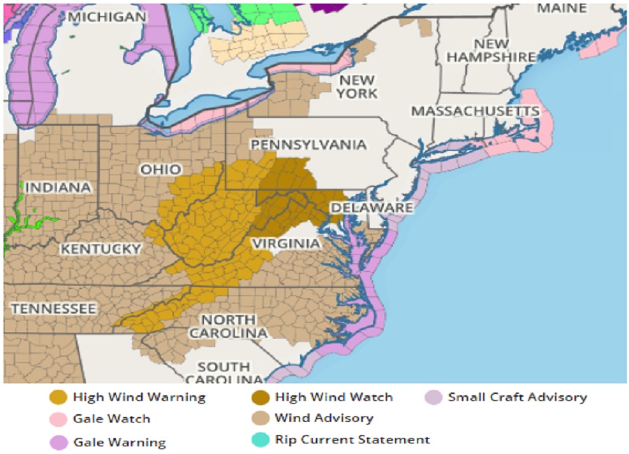
The severe weather system moving east through the Mississippi, Tennessee, and Ohio Valleys today is likely to bring more severe weather east tomorrow primarily in the form of strong, potentially damaging wind gusts. Due to that threat, the National Weather Service has issued High Wind Warnings for portions of eastern Ohio, western Pennsylvania, Virginia, and North Carolina, and much of West Virginia. High Wind Watches have been issued for portions of Pennsylvania, Maryland, and Virginia. The High Wind Watch now includes both the Baltimore and Washington DC metro areas. Wind Advisories are also up for a much broader area from New York to South Carolina, and from Kentucky to Maryland.
As a decaying squall line approaches during the pre-dawn hours in places where the High Wind Warning is in effect, there could be damaging wind gusts. Deep mixing between a departing cold front and a secondary cold push will support damaging wind gusts late Saturday morning into Saturday afternoon.
Even places only under a Wind Advisory now could see damaging winds. Southwest winds 20 to 30 mph with gusts up to 30 mph are possible from Saturday morning through to early Sunday morning. In these types of winds, unsecured objects could blow about and tree limbs could be blown down. Power outages are possible. Locally stronger wind gusts could also exist in heavy showers and thunderstorms expected to fire up during the PM hours on Saturday in portions of New York, New Jersey, Connecticut, Pennsylvania, Maryland, and Delaware.