• Skip to primary navigation
  • Skip to main content
  • Skip to primary sidebar

Weatherboy

Weatherboy Weather News, Maps, RADAR, Satellite, and Forecasts.

  • Local
  • Earth Science News
  • RADAR
  • Current Warnings
  • Satellite
  • Current Maps
  • Forecast Maps
  • Video

Weatherboy Team Meteorologist

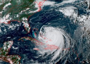
Watches Issued, Evacuations Ordered for U.S. East Coast as Hurricane Erin Gets Larger

by Weatherboy Team Meteorologist - August 18, 2025

The current view of Major Hurricane Erin from the GOES-East weather satellite. Image: NOAA

[…]

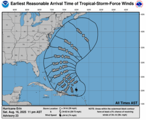
Major Hurricane Erin to Lash U.S. East Coast with Rough Surf
by Weatherboy Team Meteorologist - August 17, 2025

This map, based on the latest forecast track from the National Hurricane Center, shows how soon tropical storm force winds could be expected from Hurricane Erin has it moves up along the East Coast in the coming days. Image: NHC

[…]

Hurricane Erin Forecast to Undergo Rapid Intensification to Major Status

by Weatherboy Team Meteorologist - August 15, 2025

Hurricane Erin, circled in red, is forecast to become larger and stronger this weekend as it heads west. Image: NOAA

[…]

Earthquake Rattles North Carolina; Hundreds Report Shaking

by Weatherboy Team Meteorologist - August 14, 2025

Today's earthquake struck at the orange dot inside the colored concentric circles today. Image: USGS

[…]

Concern About Gulf of America System in Addition to Erin

by Weatherboy Team Meteorologist - August 14, 2025

The National Hurricane Center is watching two areas today: the orange circled area in the Gulf of America that could develop, the other, circled in red, which is Tropical Storm Erin which should be a hurricane by tomorrow. Image: NOAA

[…]

Erin Strengthens; On its Way To Major Hurricane Status

by Weatherboy Team Meteorologist - August 13, 2025

Latest view from the GOES-East weather satellite shows Erin over the central Atlantic inside the yellow circle. Image: NOAA

[…]

Erin’s Forecast Track Shifts Significantly West, Increasing Area on Alert

by Weatherboy Team Meteorologist - August 12, 2025

The threat of damaging winds from Erin over the next 5 days have shifted west, putting some places into a hazard zone. Image: NHC

[…]

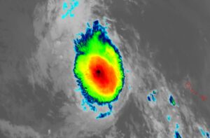
Erin Projected To Become Major Hurricane With 115 mph+ Winds
by Weatherboy Team Meteorologist - August 11, 2025

Latest color enhanced view of Erin from the GOES-East weather satellite. Image: NOAA

[…]

South Carolina Coast Rattled by Weak Earthquake

by Weatherboy Team Meteorologist - August 9, 2025

The earthquake struck at the orange dot inside the colored concentric circles. Image: USGS

[…]

Henriette Regenerates Near Hawaii, But Should Stay Away from Aloha State

by Weatherboy Team Meteorologist - August 9, 2025

Current view of Henriette east of Hawaii from the GOES-West weather satellite. Image: NOAA

[…]

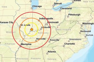
Dozens Report Shaking as Earthquake Rattles Indiana
by Weatherboy Team Meteorologist - August 9, 2025

Last night's earthquake struck at the orange dot inside the colored concentric circles on this map. Image: USGS

[…]

Earthquakes Rattle Maine, Arkansas, and Tennessee as Eastern U.S. Seismicity Continues

by Weatherboy Team Meteorologist - August 8, 2025

The earthquake epicenters struck inside the colored concentric circles on this map. Image: USGS

[…]

Weak Overnight Earthquake Rattles Massachusetts

by Weatherboy Team Meteorologist - August 7, 2025

Today's earthquake struck at the orange dot inside the colored concentric circles on this map. Image: USGS

[…]

Tropical Cyclones to Miss Direct Impacts on Hawaii But Bring Welcome Moisture

by Weatherboy Team Meteorologist - August 6, 2025

Latest official forecast track for the tropical storm. Image: NHC

[…]

Thousands Report Shaking from New Jersey Earthquake; More on the Way

by Weatherboy Team Meteorologist - August 5, 2025

The epicenter of today's earthquake is at the orange dot inside the colored concentric circles on the map. Image: USGS

[…]

Increasing Odds of East Coast Tropical Cyclone Threat -or Two

by Weatherboy Team Meteorologist - August 5, 2025

The area is orange is one of two areas the National Hurricane Center is tracking for potential tropical cyclone development. Image: NHC

[…]

  • « Go to Previous Page
  • Go to page 1
  • Interim pages omitted …
  • Go to page 30
  • Go to page 31
  • Go to page 32
  • Go to page 33
  • Go to page 34
  • Interim pages omitted …
  • Go to page 263
  • Go to Next Page »

Primary Sidebar

Sponsored Ad

Search

Latest News

  • Next Tropical Disturbance to Impact U.S. Could Hit Hawaii …Again
  • Melt Pond on Mount Hood Volcano in Washington Raising Concern
  • Tornadoes Possible around Los Angeles Today
  • Morning Earthquake Strikes New Jersey West of New York City
  • Subtropical Storm Josephine Forms Southeast of New Jersey
  • Coastal Storm Could Develop Into Subtropical Storm
  • Early Morning Earthquake Shakes Georgia Southwest of Atlanta
  • Lunchtime Earthquake Rattles Western Tennessee Today
About | Careers | Contact | Contests
Terms | Privacy | Ad Choices
Weatherboy is a (R) Registered Trademark of isarithm LLC, All Rights Reserved.
All content herein is Copyright by Isarithm LLC 1997-2022

Insert/edit link

Enter the destination URL

Or link to existing content

    No search term specified. Showing recent items. Search or use up and down arrow keys to select an item.