• Skip to primary navigation
  • Skip to main content
  • Skip to primary sidebar

Weatherboy

Weatherboy Weather News, Maps, RADAR, Satellite, and Forecasts.

  • Local
  • Earth Science News
  • RADAR
  • Current Warnings
  • Satellite
  • Current Maps
  • Forecast Maps
  • Video

First Week of Expected Busy Hurricane Season Appears to Be Quiet

by Weatherboy Team Meteorologist - May 30, 2024

The latest satellite photograph from GOES-East shows no areas of concern where tropical cyclones form at this time. Image: NOAA


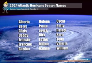
The 2024 Atlantic Hurricane Season kicks-off this weekend; while it is forecast by meteorologists at NOAA and experts at CSU to be an extraordinarily busy one, the start should be quiet with no tropical cyclone formations expected over the first week of the season. In today’s Tropical Outlook released by the National Hurricane Center, they said no storms are expected to develop over the next seven days. The 2024 Atlantic Hurricane Season begins on June 1 and runs through to November 30.

The 2024 Atlantic Hurricane Season begins on June 1; should a storm need a name prior to that date, it would pull from this list. Image: Weatherboy

While no tropical cyclone formation is expected, there are scattered weather systems and cloud clusters across the basin.  A far-eastern Atlantic tropical wave has its axis near 22W from 02N to 12N, moving westward around 15 kt. Scattered moderate to isolated strong convection is from 05N to 08N between 20W and 25W all over open water. A central Atlantic tropical wave has its axis near 41W from 02N to 11N, moving westward 15-20 kt. Isolated to scattered moderate convection is noted mainly behind the wave axis from 05N to 10N
between 35W and 40W.  A third tropical wave is over the eastern Caribbean with axis near 67W extending southward into central Venezuela where the wave is helping to induce some convective activity. It is moving westward at 15 kt.


Primary Sidebar

Sponsored Ad

Search

Latest News

  • Miami’s National Hurricane Center Monitors Area for Cyclone Development
  • Scientists Unlock Climate Change Secrets: Say Ice Age Is Coming
  • Tornado Confirmed in New Jersey
  • National Hurricane Center Initiates Daily Reports Today
  • Severe Weather Likely Across Broad Area on Friday
  • Heat Blast Expected from Texas to Florida and from Minnesota to Arkansas
  • Mid Atlantic to Become Extra Moist
  • Southeast Soaker Likely Next 72 Hours
About | Careers | Contact | Contests
Terms | Privacy | Ad Choices
Weatherboy is a (R) Registered Trademark of isarithm LLC, All Rights Reserved.
All content herein is Copyright by Isarithm LLC 1997-2022