The National Weather Service in Honolulu on the central Hawaiian Island of Oahu has issued Winter Storm Warnings for portions of Hawaii Island, also known as the Big Island, which is the south-eastern most island of the chain. A powerful winter storm is expected to bring upwards of 14″ of snow with winds whipping at a nearly unimaginable 135 mph gusts at times, which is the equivalent of a Category 4 hurricane wind speed on the Saffir-Simpson wind scale. While portions of the eastern United States could see blizzard conditions on Christmas Eve or the day before, it looks like Hawaii will be the first to get them this week in the days leading up to Christmas.
Fortunately for visitors and residents of the Big Island of Hawaii, the potent winter storm will unleash heavy snow and destructive winds at the highest elevations of Mauna Kea and Mauna Loa, the island’s two highest volcanic summits where many people visit but few people live. But unfortunately for people at lower elevations including the mega resorts at the beaches throughout the state, a rough time will be had by all with severe thunderstorms, damaging wind gusts, the threat of hail, and heavy potentially flooding rains.

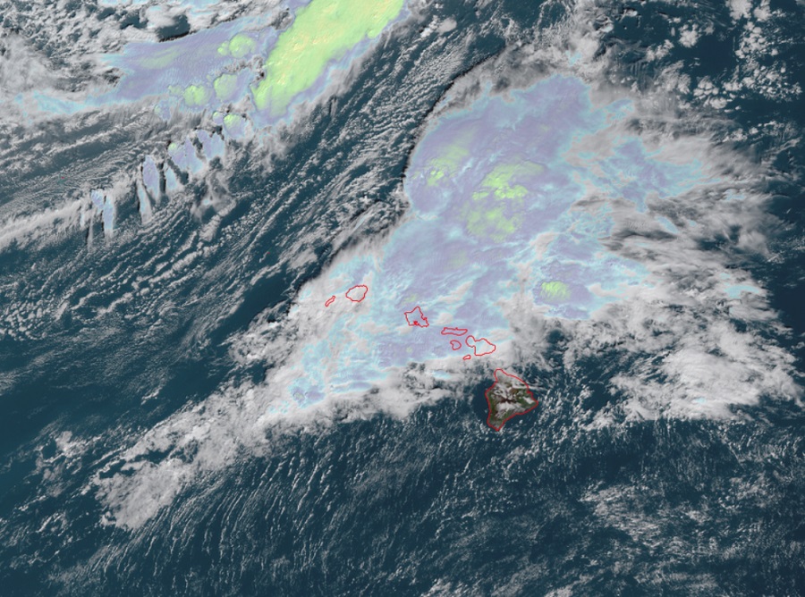
Satellite imagery from NOAA’s GOES-West weather satellite shows an impressive mid-latitude cyclone deepening over the Central Pacific Basin as it digs southeastward toward the islands. Ahead of this cyclone, increasing southerly winds are pulling moisture from the tropics and producing widespread moderate rainfall with brief periods of heavy rainfall across the smaller islands. While the heaviest rain is over Oahu and Maui County for now, this moisture axis is projected to shift east while overall atmospheric instability increases over the state. This will result in increasing rainfall amounts and intensities over Oahu, Maui County, and the Kona side of the Big Island. Winds will also be increasing from the southwest at the surface and aloft this afternoon which will increase the storm motion. This should help decrease the flooding threat slightly, but with the widespread rainfall from this morning saturating the soils already, it would only take one intense thunderstorm sitting over a particular area briefly to cause flooding concerns.
The main event will ramp up later tonight into Monday in Hawaii. As the mid-latitude cyclone continues to move closer to the state, southwest winds referred to locally as “Kona Winds” will increase with sustained southwest surface winds of 20 to 30 mph with stronger gusts expected. In areas of local accelerations, such as the Windward zones and areas downwind of terrain will be highly susceptible to downsloping which will force damaging winds to the surface. Wind gusts of over 60 mph will be possible especially over Windward Oahu and downwind of Mt. Kaala, north and east Maui, and north and east Big Island. Convective instability will also be maximized during this time which will allow for any particularly vigorous showers to have the potential to mix down severe winds up to 60 mph. For this reason, the National Weather Service has issued High Wind Warnings for the entire state.
The National Weather Service in Honolulu also cautions that a severe thunderstorm threat will exist tonight through through the time of frontal passage on Monday. Atmospheric conditions are projected to be ripe to allow northeast-moving bowing segments capable of producing damaging straight-line winds. Cold temperatures aloft will also support a marginal risk for hail of up to 1″ in diameter. Due to the severe weather threat, the Honolulu forecast office is considering issuing a very rare Severe Thunderstorm Watch for this severe weather event.
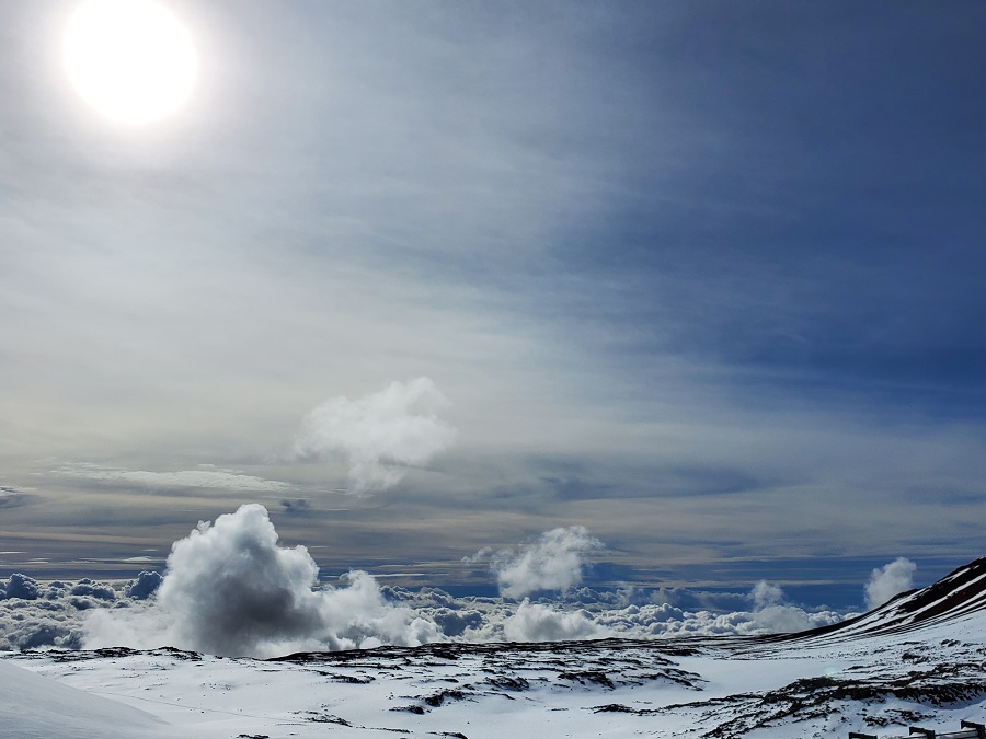
While the weather will become rough and wild throughout the state, things will take an extreme turn at the higher elevations where there’s an abundant pool of cold air to work with. In the Winter Storm Warning area for the Big Island summits, which starts at 6pm tonight and runs through 6am Tuesday, heavy snow and damaging winds are likely. Light snow accumulation tonight will be followed by periods of heavy snow on Monday, with total snow accumulations of up to 14″ possible. Wind gusts as high as 135 mph will cause significant blowing and drifting of snow there. The National Weather Service warns, “Travel will become impossible. Blowing snow will significantly reduce visibility. Periods of zero visibility expected.”

This Winter Storm Warning impacts two roads: the Mauna Loa Access Road and the Mauna Kea Access Road. Portions of the Mauna Loa Access road were inundated and destroyed by lava in the Mauna Loa volcanic eruption earlier this month. The road is closed and gated at its entrance, preventing anyone from accessing it or any portion of the fresh lava cover. For Mauna Kea Access road, officials have already closed the road due to the impending storm.
In a statement released by the Mauna Kea Rangers, they say, “The Mauna Kea Summit Access Road is CLOSED to the public at the Visitor Information Station at an elevation of 9,200 feet due to high humidity, fog, freezing temperatures and icy road conditions. There is also a winter storm warning from 6 pm this evening to 6 am Tuesday morning.” They add, “We will continue to monitor the summit road and weather conditions with updates to follow. We thank you for your patience and understanding.”
Lastly, there will also be the threat of rough and dangerous surf around Hawaii, especially on the north shores of many islands. While surf will be gradually diminishing during the day today, surf will rise rapidly tonight and Monday, and remain extra large through Tuesday. The National Weather Service says dangerously large breaking waves of 25 to 40 feet are possible within the Warning area, which includes the north and west facing shores of Niihau, Kauai, Oahu, and Molokai, and north facing shores of Maui. This warning stretches from 6 pm tonight through 6 pm Tuesday. The National Weather Service says, “Expect ocean water surging and sweeping across beaches, coastal benches, and lava flows creating the potential for impacts to coastal properties and infrastructure, including roadways. Powerful longshore and rip currents will be present at most beaches.
The Hawaii Emergency Management Agency, known as HI-EMA, is cautioning people in Hawaii to be prepared for the bad storm.
“A kona low system can bring strong gusty southerly winds across many areas that don’t usually experience them, and can easily damage roofs or send loose branches or other items flying,” said Luke Meyers, administrator of HI-EMA.
A Kona low system that struck the state in December 2021 caused millions of dollars in damage, including landslides on O’ahu and extensive flooding on Maui, and it may have contributed to a landslide that closed a road on Kaua‘i. “With the holidays coming up, we encourage residents and visitors alike to plan any activities Sunday so they can be in a safe location by the time the storm’s effects start pushing ashore,” Meyers said.
“We recommend that everyone in Hawai‘i take steps to prepare for the incoming system in case the impacts are significant, and at a minimum monitor reports as it gets closer to the State,” Meyers said.