• Skip to primary navigation
  • Skip to main content
  • Skip to primary sidebar

Weatherboy

Weatherboy Weather News, Maps, RADAR, Satellite, and Forecasts.

  • Local
  • Earth Science News
  • RADAR
  • Current Warnings
  • Satellite
  • Current Maps
  • Forecast Maps
  • Video

USGS

First Weekend of March ’24 Kicks Off With USGS Having 5 Volcanoes at “Watch” or “Advisory”

by Weatherboy Team Meteorologist - March 1, 2024

File photograph of the Gareloi Volcano. Levied lava flows from a 1980s eruption drape the south flank of the southern summit crater. Image: USGS / McGimsey R.G.

[…]

Earthquake Rattles Blue Ridge Mountains in North Carolina

by Weatherboy Team Meteorologist - February 28, 2024

The epicenter of today's earthquake was at the orange star inside the concentric colored circles on this map. Image: USGS

[…]

Over Last 7 Days, 8 Earthquakes Rattle Eastern United States

by Weatherboy Team Meteorologist - February 24, 2024

Each yellow dot represents the epicenter of an earthquake to strike over the last 7 days. Image: USGS

[…]

Weight of World’s Largest Volcano Responsible for Yesterday’s Big Earthquake
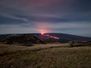
by Weatherboy Team Meteorologist - February 10, 2024

Lava flows down the slopes of Mauna Loa during the last full day of the active eruption earlier in December 2022. Image: Weatherboy

[…]

Moderate Quake Rocks Central Florida Coast; No Tsunami Threat

by Weatherboy Team Meteorologist - February 8, 2024

The epicenter of this earthquake off the Florida coast is at the orange dot inside the concentric circles on this map. Image: USGS

[…]

Shaking Reported from Fresh South Carolina Earthquake

by Weatherboy Team Meteorologist - February 6, 2024

South Carolina saw another earthquake today; the epicenter is at the orange dot inside the colored concentric circles. Image: USGS

[…]

40 Million Cubic Yards of Magma On the Move in Hawaii; USGS Changes Volcano Alert Level

by Weatherboy Team Meteorologist - February 3, 2024

Satellite derived data shows significant ground deformation, or uplift, in two areas southwest of the Kilauea caldera, caused by a large amount of magma pushing the ground up in this region from just below the surface. Image: USGS

[…]

Thousands Report Shaking from Oklahoma & New York Earthquakes

by Weatherboy Team Meteorologist - February 3, 2024

The dots inside the colored concentric circles represent where the recent earthquake epicenters were. Image: USGS

[…]

460+ Earthquakes Rock Hawaii; Volcanic Eruption Possible With Little Warning at Kilauea

by Weatherboy Team Meteorologist - February 1, 2024

In 1983, Pu'u O'O'o at Kilauea Volcano erupted, sending this fountain of lava 150 feet into the air. While Kilauea isn't erupting now, signs suggest that could soon change. Image: J.D. Griggs/ USGS

[…]

More than 220 Earthquakes Rock Hawaii; USGS Raises Volcano Alert Level

by Weatherboy Team Meteorologist - January 31, 2024

Each dot represents the epicenter of an earthquake to strike in the last 24 hours; the red dots reflect the epicenters of the most recent quakes. Image: USGS

[…]

USGS Has 1 U.S. Volcano at WATCH/ORANGE Level; 4 at YELLOW/ADVISORY Today

by Weatherboy Team Meteorologist - January 30, 2024

View of the Great Sitkin volcano from the departing Adak to Anchorage flight on March 11, 2020. Image: Ed Fischer / USGS-AVO

[…]

Nation’s Most Dangerous Volcano Showing Signs of Life

by Weatherboy Team Meteorologist - January 28, 2024

Each orange dot represents the epicenter of an earthquake to strike around Kilauea in the last 24 hours. Of note is the swarm of earthquakes happening south of the volcano's caldera, which appears as a dark crater on this view. Image: USGS

[…]

More Than 4,000 Earthquakes Strike the U.S. from New York City to Los Angeles Last 30 Days; USGS Issues New Hazard Map

by Weatherboy Team Meteorologist - January 22, 2024

Each dot represents the epicenter of an earthquake which struck over the last 30 days. The white dots reflect the oldest earthquakes while the orange dots reflect the most recent. Image: USGS

[…]

Multiple Earthquakes Rock Puerto Rico; No East Coast Tsunami Threat

by Weatherboy Team Meteorologist - January 17, 2024

The epicenter of each stronger earthquake is marked by an orange dot surrounded by a colored circle. Image: USGS

[…]

Moderate Earthquakes Continue to Strike the U.S. Midwest

by Weatherboy Team Meteorologist - January 13, 2024

Each dot represents an earthquake greater than 2.5 that has struck the area north of Oklahoma City over the last 7 days. Image: USGS

[…]

People Report Shaking in Louisiana from Earthquake; Third Time This Week

by Weatherboy Team Meteorologist - January 12, 2024

Three earthquakes struck in the same general area in recent days in northwestern Louisiana; each dot inside the colored concentric circles indicates the epicenter of an earthquake. Image: USGS

[…]

  • « Go to Previous Page
  • Go to page 1
  • Interim pages omitted …
  • Go to page 18
  • Go to page 19
  • Go to page 20
  • Go to page 21
  • Go to page 22
  • Interim pages omitted …
  • Go to page 36
  • Go to Next Page »

Primary Sidebar

Sponsored Ad

Search

Latest News

  • Freeze Grips Nine Southern States, with Colder Night Ahead
  • Towering Waves Pound West Coast, Prompting Evacuation Warnings
  • Magnitude 3.4 Earthquake Strikes Remote Northern Alaska Near Kobuk
  • Freeze Warnings Stretch Across South Ahead of Colder Weekend
  • Storm Brings Sierra Snow and Big Surf to California
  • Heavy Wet Snow Cuts Power Across Central New York
  • Pacific Storm to Bring Heavy Sierra Snow and 30-Foot Surf to Northern California, Oregon Coasts
  • Llano River overflows in Texas Hill Country as South Texas Storm Winds Down
About | Careers | Contact | Contests
Terms | Privacy | Ad Choices
Weatherboy is a (R) Registered Trademark of isarithm LLC, All Rights Reserved.
All content herein is Copyright by Isarithm LLC 1997-2022

Insert/edit link

Enter the destination URL

Or link to existing content

    No search term specified. Showing recent items. Search or use up and down arrow keys to select an item.