• Skip to primary navigation
  • Skip to main content
  • Skip to primary sidebar

Weatherboy

Weatherboy Weather News, Maps, RADAR, Satellite, and Forecasts.

  • Local
  • Earth Science News
  • RADAR
  • Current Warnings
  • Satellite
  • Current Maps
  • Forecast Maps
  • Video

Oahu

Tropical Storm Olana Forms; Flooding Rains Possible in Hawaii

by Weatherboy Team Meteorologist - October 25, 2026

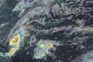
Latest weather satellite view of Tropical Storm Olana from the GOES-West satellite. Image: NOAA

[…]

Next Tropical Disturbance to Impact U.S. Could Hit Hawaii …Again
by Weatherboy Team Meteorologist - October 24, 2026

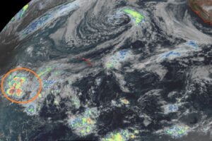
The area circled in orange south and west of Hawaii is forecast to move closer to Hawaii in the coming days, bringing heavy rains and strong, potentially damaging wind gusts, to the State of Hawaii. Image: NOAA

[…]

Hurricane Nolo Forecast to Become Major Hurricane Soon
by Weatherboy Team Meteorologist - September 25, 2026

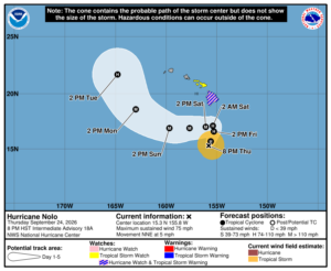
Latest forecast track and advisories for Hurricane Nolo. Image: NHC

[…]

Catastrophe Forecast for Hawaii as Hurricane Nolo Develops

by Weatherboy Team Meteorologist - September 24, 2026

Even without a direct landfall forecast, Nolo is expected to bring epic heavy rains to Hawaii and Maui, triggering catastrophic floods and landslides. Rainfall will be measured in feet across a large area depicted on the map. Image: NHC

[…]

Three Systems Brewing in Pacific; Two May Impact Hawaii
by Weatherboy Team Meteorologist - September 16, 2026

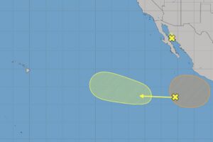
The three shaded areas of concern are being tracked for potential tropical cyclone development. Image: NHC

[…]

Hawaii on Edge as Norbert is Forecast to Grow into Hurricane

by Weatherboy Team Meteorologist - September 11, 2026

Latest forecast track for Norbert. Image: NHC

[…]

Warnings Expand to Honolulu as Hurricane Lowell Shifts East

by Weatherboy Team Meteorologist - September 7, 2026

Latest satellite view of Hurricane Lowell as it approaches the western part of Hawaii. Image: NOAA

[…]

Hurricane Warning Up As Hawaii Braces for Hurricane Lowell’s Wind, Rains, & Surf
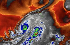
by Weatherboy Team Meteorologist - September 6, 2026

This view from the GOES-West weather satellite shows both Hurricane Lowell getting closer to Hawaii while a tremndous amount of moisture and clouds east of it is moving north into the state. Image: NOAA

[…]

Heavy Rain, Gusty Winds to Move Across Hawaii as Hurricane Lowell Aproaches
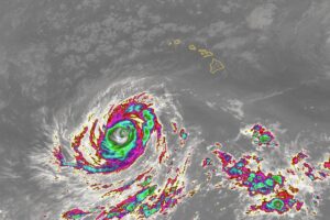
by Weatherboy Team Meteorologist - September 5, 2026

Color enhanced infrared image from the GOES-West weather satellite shows Lowell swirling south of the state of Hawaii now. Image; NOAA

[…]

Three Storms to Dance Around Hawaii; Will One Hit?
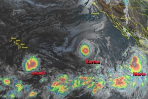
by Weatherboy Team Meteorologist - September 1, 2026

The latest GOES-West weather satellite view showing three named storms marching across the Pacific Ocean. Image: NOAA

[…]

Deadly & Destructive Hurricane Lala Weakens & Heads West
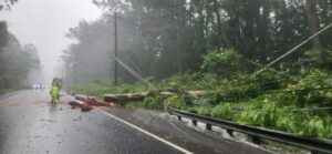
by Weatherboy Team Meteorologist - August 16, 2026

Countless trees and wires are down around the islands of Hawaii. This is the view of Highway 130, also known as Keaau-Pahoa Road near mile-marker 12 on the Big Island of Hawaii. Image: Hawaii Department of Transportation

[…]

Aloha Hurricane Lala as Storm Impacts Big Island of Hawaii; Could Be a Record

by Weatherboy Team Meteorologist - August 15, 2026

Latest official track for Lala along with current warnings. Image: NHC / CPHC

[…]

Watches & Warnings Expand in Hawaii Ahead of Hurricane Lala Impacts
by Weatherboy Team Meteorologist - August 14, 2026

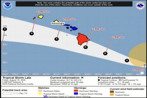
The latest official forecast track and watches/warnings for Lala. Image: NHC/CPHC

[…]

Hurricane Warning Issued for Hawaii Island; Tropical Storm Watch Up for Maui & Oahu
by Weatherboy Team Meteorologist - August 13, 2026

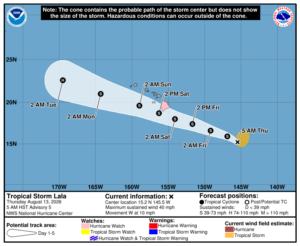
Latest forecast track and advisories for Lala. Image: NHC / CPHC

[…]

Two Systems Taking Shape Near Hawaii; Could Threaten Islands This Weekend
by Weatherboy Team Meteorologist - August 12, 2026

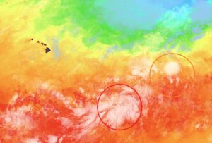
The two systems circled on this map could become tropical cyclones in the coming days, perhaps impacting Hawaii by the upcoming weekend. This view from NOAA's GOES-West weather satellite is color-enhanced to show the sea surface temperature around the islands; areas of orange and red are conducive to intensification. Image: NOAA

[…]

Massive Pacific Earthquake Triggers Tsunami Advisory by U.S. Tsunami Warning Center

by Weatherboy Team Meteorologist - June 7, 2026

The earthquake responsible for potential tsunami is located at the red dot inside the concentric colored circles on this map. Image: NWS NTWC

[…]

  • Go to page 1
  • Go to page 2
  • Go to page 3
  • Go to Next Page »

Primary Sidebar

Sponsored Ad

Search

Latest News

  • Heavy Rain Threatens Flash Flooding in South Florida Days after Record King Tide Swamped the Coast
  • Severe Storms and Tornado Threat to Sweep From New Mexico into the Southern Plains Sunday Night and Monday
  • Rare Autumn Atmospheric River Drenches Arizona and Southern Utah, Raising Flash Flood Threat on Saturated Ground
  • FEMA Uses Halloween to Warn Americans to Prepare For Emergency or Disaster
  • Halloween Storm Brings Season’s Heaviest Snow Yet to Sierra Nevada Peaks
  • King Tide Flooding Lingers in Florida Keys and Along Atlantic Coast as Heavy Rain Looms
  • Atmospheric River Takes Aim at Waterlogged Arizona after Friday Flash Floods
  • Overnight Earthquake Shakes Eastern Tennessee Near Knoxville
About | Careers | Contact | Contests
Terms | Privacy | Ad Choices
Weatherboy is a (R) Registered Trademark of isarithm LLC, All Rights Reserved.
All content herein is Copyright by Isarithm LLC 1997-2022

Insert/edit link

Enter the destination URL

Or link to existing content

    No search term specified. Showing recent items. Search or use up and down arrow keys to select an item.