2018 was a big year for Earth science! Some of the worst tropical cyclones to ever impact the United States hit, while countless floods and wildfires raged across the country. Meanwhile, lots of science entered space to study Earth, launched from both the U.S. and Europe. Both American and European satellites help collect weather data used in global forecast models and harvest data and imagery around natural disasters.
Fires ravaged the west coast of the United States and Hawaii, burning millions of acres of land. In California alone, it was the most destructive, deadliest, and largest wildfire season on record with a total of 8,527 fires burning an area of 1,893,913 acres. 98 people and 6 additional firefighters were lost to the fires there. Hawaii saw it’s second largest wildfire on record while places in the Pacific northwest also saw significant wildfire activity. Smoke from the fires in the western U.S. blew as far west as Hawaii and as far east as the New England coast, filling the air with haze and bringing vibrant reds and oranges to evening sunsets in the summer and fall.
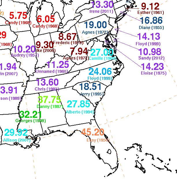
While the west was burning, the East was drowning. The eastern U.S. saw the heaviest annual rainfall amounts on record, with many reporting stations smashing annual records well before the year ended. Hurricane Florence drenched much of the East Coast, adding to heavy rain totals that fell from a mix of tropical and non-tropical systems. 78 cities across the United States are on track to have their wettest years on record when the record books close tonight. At least 16 of those have already broken their yearly records, according to data from NOAA Regional Climate Centers.
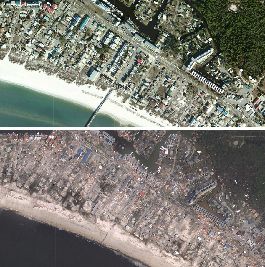
Tropical cyclones also brought destructive winds to the United States this year. Hurricane Michael was the third most intense hurricane to strike the continental U.S., blasting the Florida panhandle with Category 5 hurricane gusts. Parts of the coast are almost unrecognizable after powerful winds and a huge storm surge made its way from the Gulf of Mexico well inland, destroying a large swath of coastal properties. While the continental United States dealt with the aftermath of Michael, Saipan and Guam dealt with the wrath of Super Typhoon Yutu. The U.S. Commonwealth of the Northern Mariana Islands saw tremendous destruction when Yutu’s 200mph+ winds blasted the area.
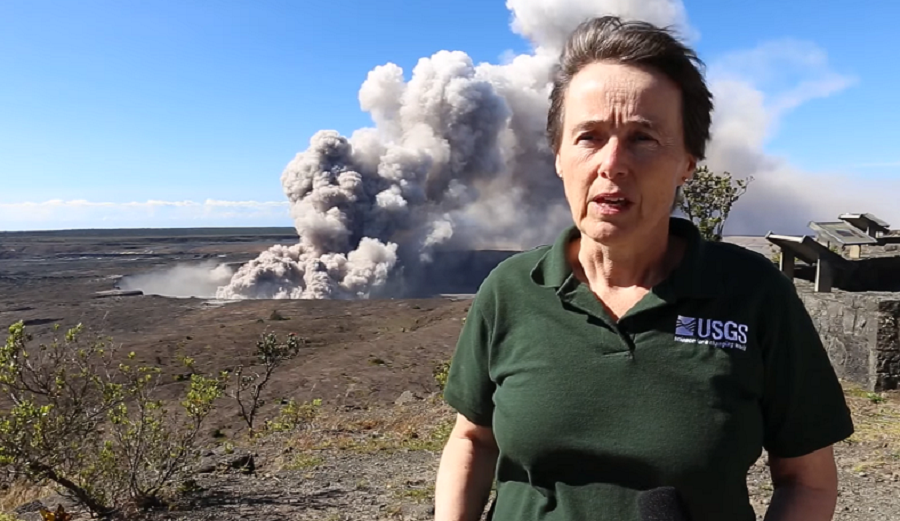
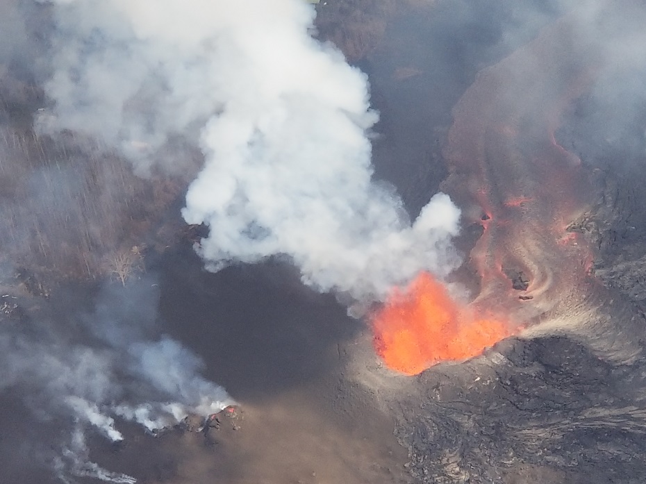
However, the most impactful Earth science story this year was undoubtedly the 2018 Kilauea Eruption of the Lower East Rift Zone on Hawaii’s Big Island. While hurricanes, wildfires, and floods erased scores of homes around the country, no event was more unpredictable and more permanent than the volcanic eruption in Hawaii. While neighborhoods destroyed by storms, like Mexico Beach, Florida will recover over time, a large part of an area rich with residential neighborhoods and agricultural lots will be forever buried in thick lava rock. The eruption was so significant that the Honolulu office of the National Weather Service had to create new volcanic ash advisories to warn residents and visitors of the dangers there.
The volcanic event in Hawaii was a multi-month ordeal that started in May. On May 4, a 6.9 magnitude earthquake hit the Puna of eastern Hawaii. Just a few weeks later, by May 27, 2018, 24 fissures had erupted lava in or near the Leilani Estates and Lanipuna Gardens subdivisions of Hawaii. The Puna Geothermal Venture, which provided one-quarter of the island’s electricity, was forced to shut down and was later damaged by lava. Work began in December to bring the plant back to life, although the company said any such effort would take more than a year to complete.
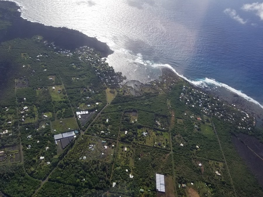
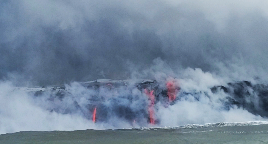
On May 29, lava from a new northeastern flow overran Hawaii Route 132, cutting the access between Kapoho and Pāhoa. On June 4, the immense lava flow reached the Pacific Ocean at Kapoho Bay. The northeastern flow of lava quickly moved forward and destroyed the subdivision of Vacationland. By the next day, Kapoho Bay was completely filled in with lava. The destruction in early June made Kilauea the most destructive volcano in the United States since the 1980 eruption of Mount St. Helens.
On December 5, after three months of inactivity, scientists considered the eruption over. However, USGS continues to warn that volcanoes remain somewhat unpredictable and that an eruption can resume in the Lower East Rift Zone or elsewhere around Kilauea with little notice.
Beyond losses from canceled vacations and a damaged tourism industry, the eruption claimed no lives. However, 1 person remains missing while 24 were injured in the eruption event. Damage estimates continue to be added, but the toll currently stands at about $800million and growing.
The eruption event was covered by social media, with Ikaika Marzo and Phil Ong become internet stars with their in-depth video and analysis of the ongoing disaster in Hawaii.
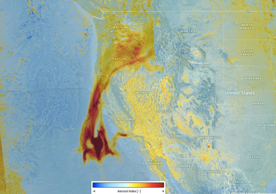
While a lot was happening on Earth, plenty was happening above it too. The high-tech GOES-S weather satellite was launched from NASA’s Kennedy Space Center in March. However, a failure of a cooling system has somewhat crippled the satellite, not providing scientists with the full suite of data they were initially hoping for. In November, ESA launched the METOP-C weather satellite. Combining data captured by GOES-S and other polar orbiting satellites, computer forecast models are now armed with huge amounts of data which should lead to more accurate forecasts. ESA’s Sentinel satellites were used to monitor the volcanic situation in Hawaii while the GOES satellites provided fire data for wildfires in the US.
Sadly, the weather community also lost some high profiled meteorologists over the year. Famed Storm Chaser Joel Taylor died of a drug overdose while on a cruise. WBNS-TV meteorologist Chris Bradley lost his battle to cancer earlier this month. Detroit meteorologist Jessica Starr took her own life after experiencing difficulty after a Lasik procedure on her eyes.
